As part of my ANAT Water Themed Residency, I have been developing new experiments in TouchDesigner that explore the relationship between site, data, and simulation. My latest work explores point cloud scans captured at the abandoned Fishermans Bend site, the future home of South East Water’s new recycling plant.
From Site to Simulation
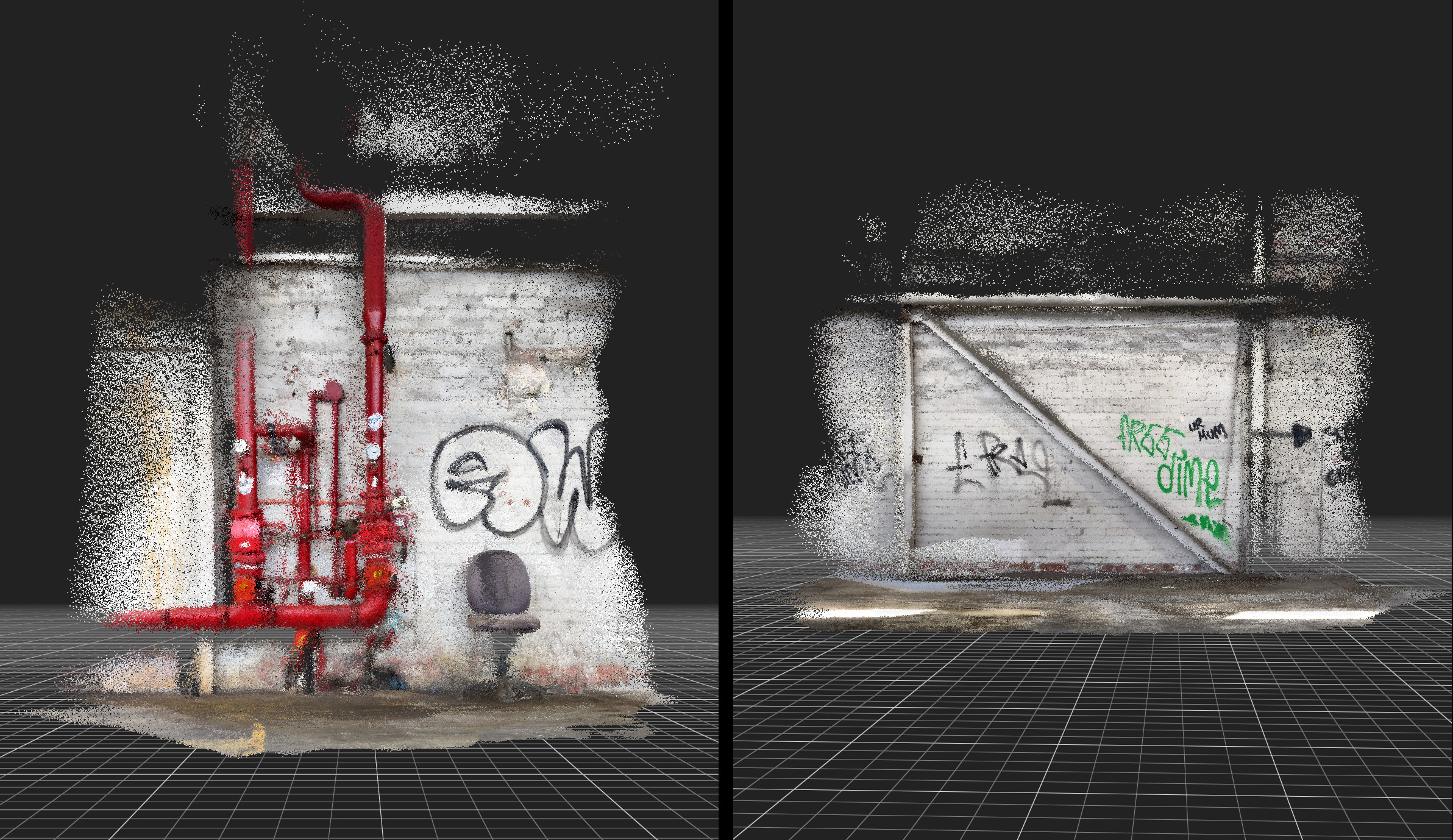
The process began with point cloud scans of the Fishermans Bend site in the multiple warehouse spaces, a location marked by its industrial history and now it’s evolving role in Melbourne’s future water infrastructure.
I worked with SiteScape, an app downloaded to my IPhone and uses its LIDAR sensor. This sensor projects thousands of infrared laser pulses into the environment. By measuring how long each pulse takes to return (“time of flight”), the sensor calculates accurate depth maps. This gives a live 3D map of the space, even in low light.
These scans were then imported and processed in TouchDesigner, where the raw geometric data became the framework for a new simulation. To animate this environment, I introduced a water simulation driven not by arbitrary physics, but by tidal data from the first six months of 2025 accessed online at the Bureau of Meteorology (BOM). This dataset, capturing the ebb and flow of tides, was mapped into the simulation to generate movement, rhythm, and flux across the scanned landscape.
Data as an Active Force
The tidal data informed multiple layers of the simulation, influencing the flow, intensity, and texture of the water surface. What emerges is a visualisation where the scanned site and the surrounding water systems intersect: the built environment of Fishermans Bend merges with the tidal cycles that shape its context.
This approach positions data not as static information, but as an active force that animates and reshapes virtual space. The simulation becomes both a record of place and a speculative vision, where industrial futures and ecological rhythms converge.
Towards Future Environments
This experiment is an important step in my research into how environmental data can drive real-time virtual environments. I am interested in how these processes might be scaled into larger Unreal Engine ecosystems, where site scans, water simulations, and sound can converge to create immersive experiences that make visible the unseen flows of data and environment.
By weaving point clouds with tidal information, this work begins to ask: how might digital tools help us listen differently to place? How can simulation reveal the entangled futures of water, industry, and ecology?